
Projected Urban Growth
May 9, 2013
(Last modified Oct 29, 2014)
Created by
Ed Laurent

This item is included in Data Basin, but has not been added to the AdaptWest.
- Description
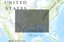
- A map showing urbanization projections for several southeastern states. The map also includes data layers for states, counties, and terrestrial conservation areas.
- Location
- Credits
- Ed Laurent
- Use Constraints
 This work is licensed under a Creative Commons Attribution 3.0 License.
This map is visible to everyone
Bookmarked by
4 Members
,
2 Groups
Included in
2 Public Galleries
About the Map Author
Ed Laurent
Executive Director with Connecting Conservation
Founder and Executive Director of Connecting Conservation. Providing technical advice and support for the coordination and integration of conservation activities across the southeast region and the United States.